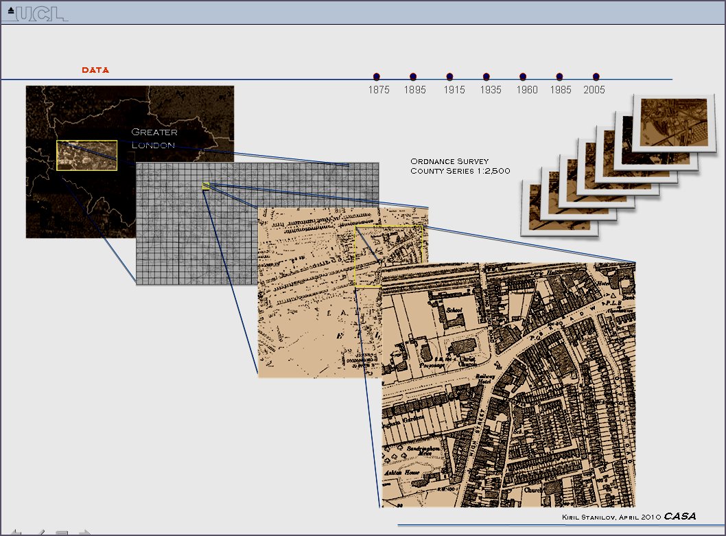
The West London model developed by Kiril Stanilov takes a slice across the metro area from west central London to the M25 orbital road. This is representation of several slices in different directions from the centre, in a casual and historical sense that is. Kiril coded all the land uses at plot level from old maps and produced a remarkable time series of development from 1870 to the present day. The paper we refer to (click here) is useful but the best quick summary is from Kiril’s own powerpoint which is also reproduced, a screen shot of which follows. Click there to load the PDF of this presentation.
UNDER DEVELOPMENT …..