
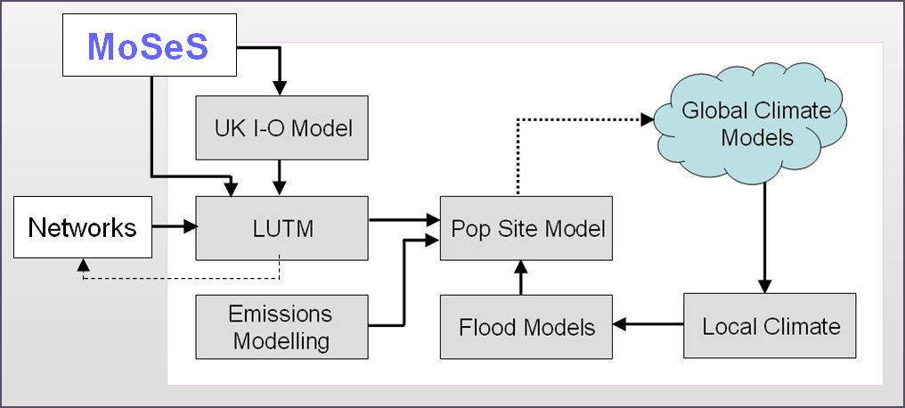
We are only just putting up the material for this model but to wet your appetites, this model is essentially a residential location model nested within a process of integrated assessment driven by an input-output model that produces employment estimates for regional areas in the UK, one of which is the London region. These estimates are then proportioned into small areas for the residential location models which are based on wards. Then the model, the subject of this area of our science, generates population by small areas that are tested using a CA-like urban development model down at the 50 metre grid square level. This sets up the predictions to be compared against estimates of flooding driven by the flooding models. The demography of the entire process is structured using the MoSeS model while pollution estimates and future energy demands for the London region are modelled in the aggregate. Here is the block model of this process.
You can read a short note on this model and the wider process which was written in the autumn-winter edition of ArcNews if you click here or on the picture left which loads the pdf of this new item.
There are other articles and presentations on this site that describe this process of integrated assessment modelling buy the Tyndall Cities Report is a good summary. Click here.
UNDER DEVELOPMENT …..