Later Animations of LUTI Models from 2000 onwards
The LUTI models that we are building in CASA are essentially aggregate and cross sectional models, that simulate the imputed equilibrium of a city at a point in time. The argument is that such models represent all of a place’s history up to that point and represent a kind of average of this history. We are particularly interested in simulating these structures visually and both are Tyndall and Arcadia models are structured to be run in a visual environment. Here are some movies which we have made. Note that we are keen on linking these models to external software and thus we are using Google Earth and World Wind to simulate the outputs in 3D. I am experimenting with these movies and there are some crude versions without sound here at present.
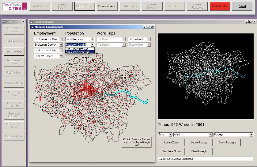
The Tyndall LUTI Model is residential location model in fast desktop form. It takes about 5 secs to run the model on a fast 2011 PC. If you click on the panel below which shows the basic frame and toolbar for the model, all will be revealed. Note that it is a movie of someone – me – running the model on the desktop so don’t try running the movie yourself. Just wait and watch and when it ends go back to this page.
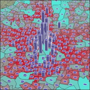 One of the nice things about this interface is that it is linked to Google Earth – we can show whatever is produced on the desktop in map and 3D form in Google Earth by converting the data to a KML file and loading this in on-the-fly, as the program runs. On a big screen this provides a remarkable display and here is a clip of this media being generated by the model on the desktop and then loaded into Google Earth. One of our more impressive products in CASA, courtesy of Richard Milton. Enjoy. Click left and wait a bit.
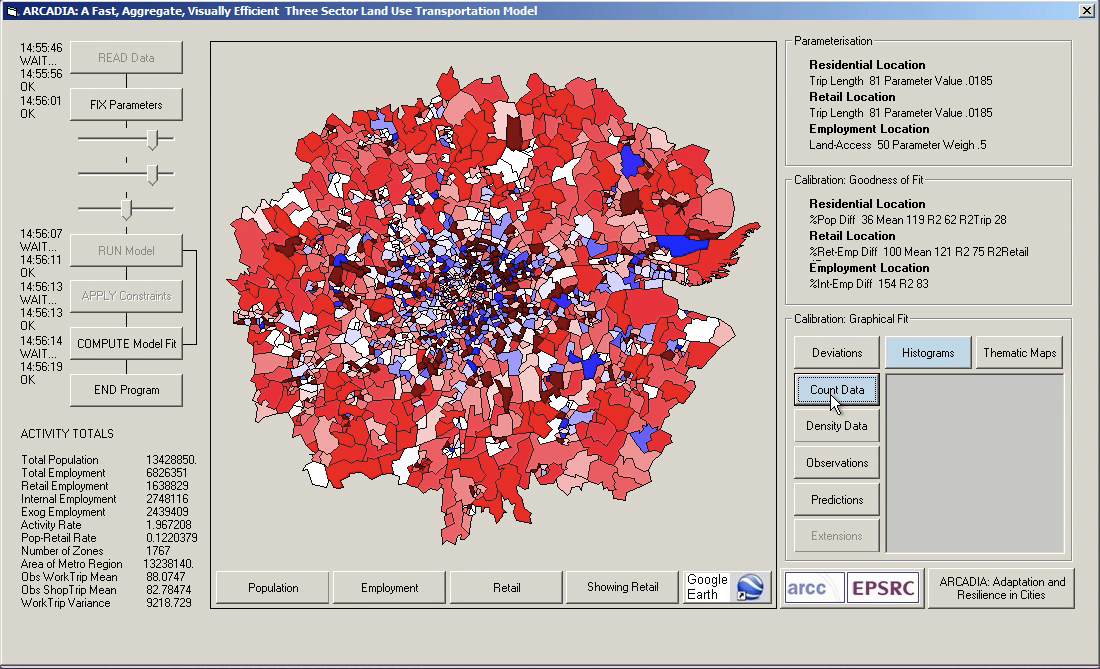
The Arcadia LUTI Model is a 3 sector employment, retail and residential location model which takes 5 seconds to run on a fast 2011 PC. Click here and below for the movie.